With 5 days in Yosemite, Sequoia, and Kings Canyon, you’ll enjoy a comprehensive overview of California’s three most popular national parks.
Building off our recommended 3-day itinerary, this page offers a suggested itinerary for 5 days in Yosemite, Sequoia, and Kings Canyon. You’ll see each park’s top highlights, including popular day hikes, iconic viewpoints, and more.
Note: Yosemite often requires reservations for entry at various points during the year, including February Firefall. Always check the current reservation requirements for the dates you plan to visit.
Jump to:
- Itinerary: 5 Days in Yosemite, Sequoia, and Kings Canyon
- Day 1: Yosemite Valley
- Day 2: Yosemite’s High Country
- Day 3: See Yosemite’s Iconic Overlooks, Drive to Kings Canyon
- Day 4: Sequoia National Park
- Day 5: Sierra Backcountry
- How to Transit Between Yosemite and SEKI
Itinerary: 5 Days in Yosemite, Sequoia, and Kings Canyon
While this itinerary is a faster pace than a more languid weeklong trip, 5 days in Yosemite, Sequoia, and Kings Canyon is the reasonable minimum to experience the “trifecta” of California national parks.
Anything less is a rushed trip, but 5 days will allow you to see the top highlights of each park.
- Day 1: Yosemite Valley (overview of the park’s most famous landmarks)
- Day 2: Yosemite High Country (more wild beauty of the High Sierra)
- Day 3: Yosemite’s Iconic Overlooks (Tunnel View and Glacier Point), Drive to Kings Canyon (see General Grant – the world’s second largest tree)
- Day 4: Sequoia (Giant Forest including General Sherman – the world’s largest tree, plus Crescent Meadow and Moro Rock)
- Day 5: Sierra Backcountry (hike the Watchtower Trail)
Note: This itinerary goes north to south, for those coming from Northern California (San Francisco). If you’re coming from Southern California instead (L.A., San Diego), simply flip the order.
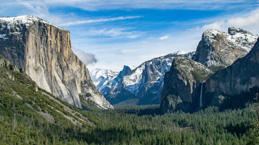
Day 1: Yosemite Valley
Yosemite Valley is the heart and soul of the park, and many of its most famous landmarks are within a 30 minute drive. Spending your first day in the valley is a good way to get oriented and see the park’s top highlights.
Arrive early morning. Plan to be at the entrance by 9 a.m. (although earlier is better) and head to Yosemite Valley (directions).
If you want to hike, go early while the day is still cool. The most famous hike in Yosemite Valley is the Mist Trail, which gets you up close to Vernal Falls (2.4 miles roundtrip) and Nevada Falls (keep going past Vernal, for 5.7 miles roundtrip). While the mileage doesn’t seem far, note that it’s uphill the whole way.
Getting to the Mist Trail: The trailhead (directions) is accessible only by foot. If you're driving, you can park by Happy Isles/Curry Village, either along the road or in the parking lot. From there it's a 0.5-1 mile walk along the road to the trailhead.
If you prefer an easier hike without the elevation gain, Mirror Lake is another good option. The trail is a relaxed 4.4 miles roundtrip, to a serene little lake in the shadow of Half Dome.
Getting to Mirror Lake: The Mirror Lake trailhead is only accessible by foot (directions). Park at Curry Village or take the free valley shuttle (get off at stop #17). You can also walk from the Upper Pines, Lower Pines, and North Pines campsites.
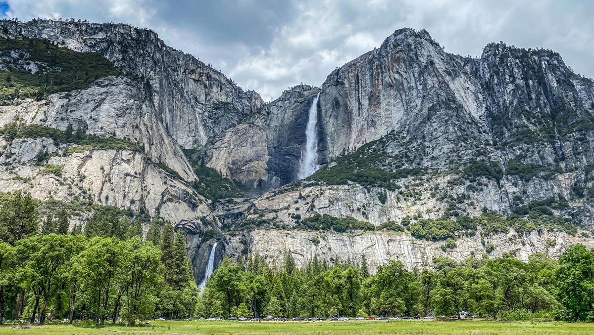
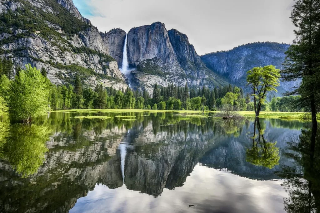
Explore Yosemite Valley. Take some time to stroll the paved paths that wind through the valley meadows. Here, you’ll also find Yosemite Falls, North America’s tallest waterfall (trailhead directions). If you’re hungry, stop at Yosemite Village for lunch.
If visiting during the summer months, cool off in the Merced River and beat the afternoon heat. Head to either Sentinel Beach (directions) or Cathedral Beach (directions), where you can easily idle away an hour on the sandy banks.
Both beaches have parking lots for easy water access, and stellar views. Sentinel Beach looks out to Yosemite Falls, while Cathedral Beach sits in the shadow of El Capitan.
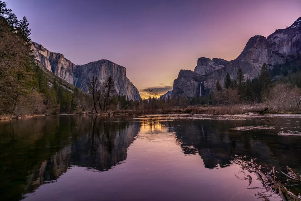
Stop for a photo at Valley View. This tiny pull-out has one of the best vantage points of Yosemite Valley, framed by El Capitan on the left and Half Dome on the right (parking lot directions here).
In late afternoon/early evening, bring a picnic to the meadow across the road from the famed El Capitan. This is our favorite way to end the day in Yosemite Valley, with an up-close view of one of the park’s most famous landmarks (and one of the world’s top rock-climbing destinations).
As the sun starts to set, you’ll catch the rosy alpenglow stretching across the granite monolith. And if you look very closely, you might even see rock climbers scattered across the face. They look like tiny specs to the naked eye.
Park along Northside Drive at the base of El Cap (directions), and choose a comfy spot in El Capitan Meadow. If you didn’t bring your own picnic provisions, you can stop by the store in Yosemite Village.
Day 2: Yosemite’s High Country

To fully appreciate the biodiversity of Yosemite, spend today in the High Sierra. It’s a completely different ecosystem from temperate Yosemite Valley, with the higher elevation creating a more stark beauty of scraggly trees and windswept meadows.
Begin the day exploring Tuolumne Meadows, the most well-known destination in the high country. Directions.
Those looking to hike can choose between Cathedral Lakes (the most iconic hike in this region, 8.6 miles roundtrip; directions) or Middle Gaylor Lake (a sharp, quick uphill for panoramic views above Tuolumne Meadow, 2.4 miles roundtrip; directions).
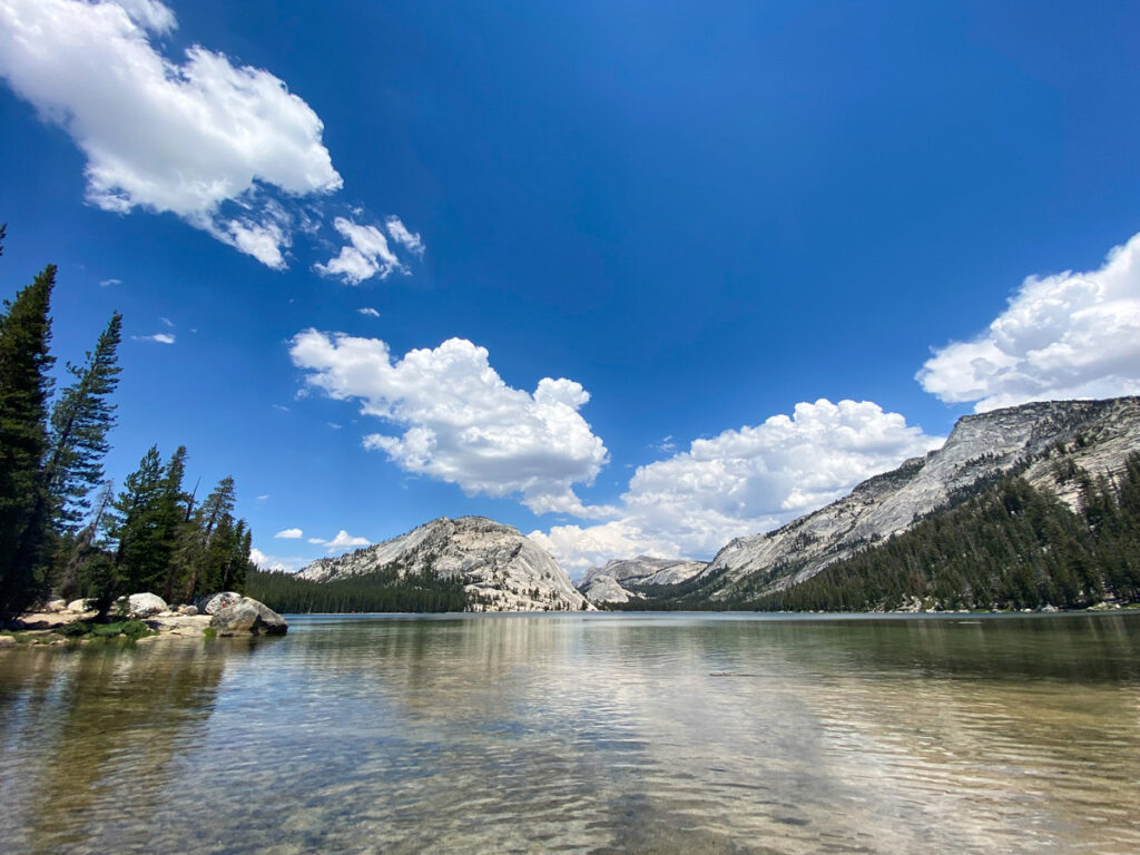
Relax on the banks of Tenaya Lake. This pristine alpine lake has miles of shoreline to post up with a picnic lunch, and cool off with a swim or paddle in the warm months. Parking can be found at the Tenaya Lake Picnic Area (directions) or Murphy Creek Trailhead (directions).
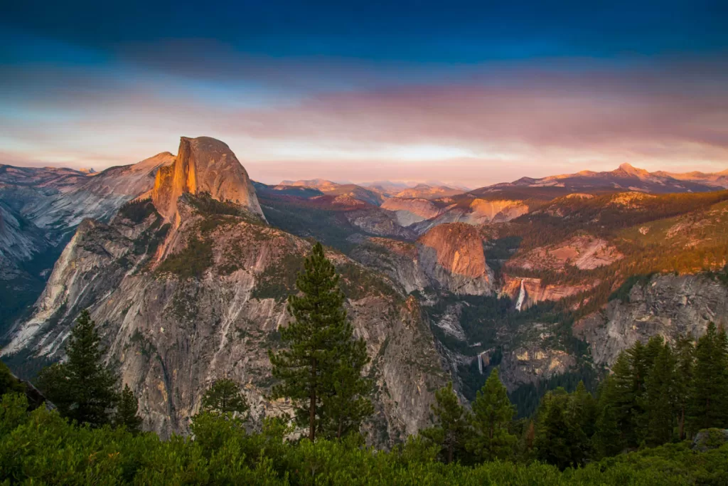
Stop off at Olmsted Point on your drive back, for a different perspective of Yosemite Valley. You’ll see Clouds Rest in the foreground, while Half Dome features prominently in the distance. Directions.
Day 3: See Yosemite’s Iconic Overlooks, Drive to Kings Canyon
Today’s itinerary gets you to Tunnel View and Glacier Point (Yosemite’s two most famous overlooks) before leaving the park for Kings Canyon.
Stop at Tunnel View first, for a sweeping view of Yosemite Valley (directions here). The vantage point is just a quick 5-minute outing, but if you’re looking for the perfect photo op for your trip, this is it.
Visit Glacier Point for the best panorama of Half Dome and the High Sierra. Note that driving out-and-back from Tunnel View to Glacier Point takes 45 minutes each way, but the vistas are well worth it (directions).
Take a hike near Glacier Point. If you want to stretch your legs, you can either stroll the paved paths along the Glacier Point promontory, or stop to hike at one of the numerous trailheads along the drive.
Taft Point is another great option: 2.3 miles roundtrip, to dizzying views of Yosemite Valley 3,000 feet below (directions here).
Just remember that the drive to Kings Canyon will take nearly 3.5 hours, so plan your timing accordingly.
Drive to Kings Canyon. The route will take you out of Yosemite’s southern entrance, passing landmarks like the historic Wawona Hotel on the way.
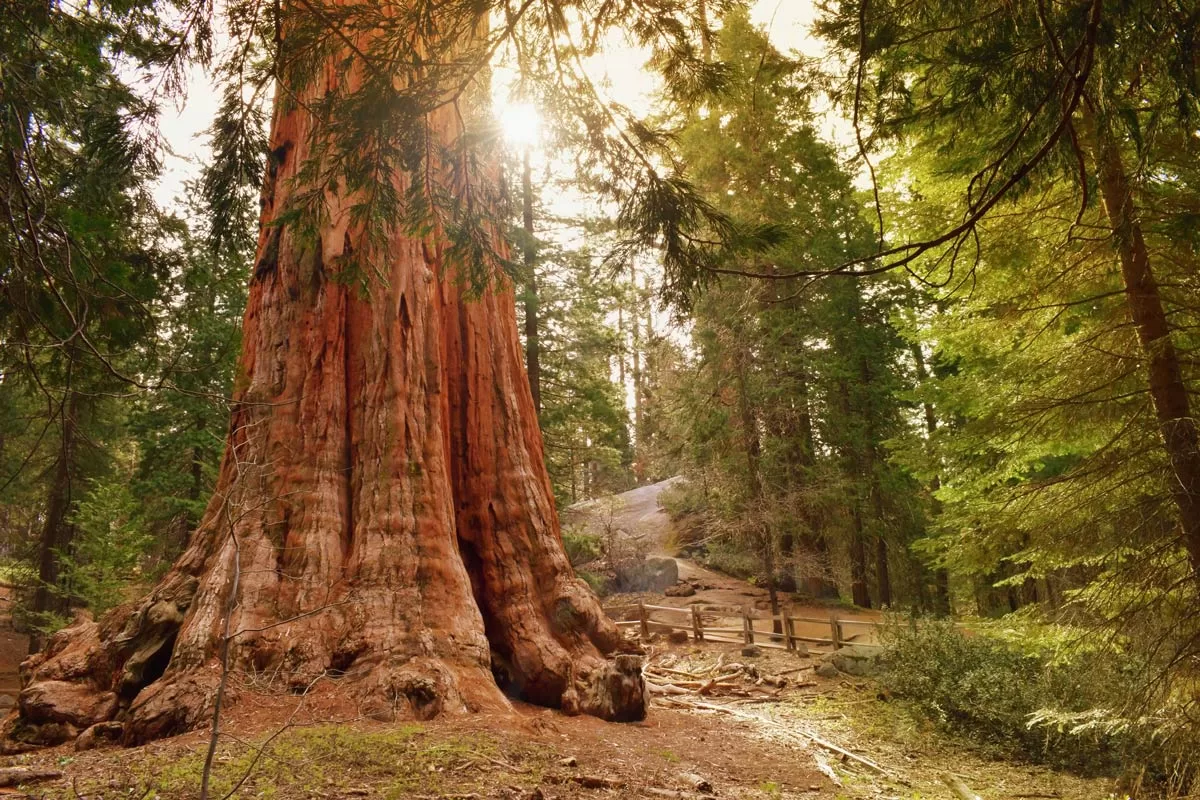
Once you get to Kings Canyon, head to Grant Grove and see General Grant. General Grant is the second largest sequoia tree in the world, standing nearly 290 feet tall and 29 feet wide.
The General resides in Grant Grove, an easy 0.3-mile loop along the forest floor. Along the way, you’ll pass other giant sequoias and Gamlin Cabin, built by two brothers who lived here in the 1870s. Directions.
Optional: Stop at Big Stump Grove, just south of Grant Grove. While it’s not a major tourist landmark, it makes another fun photo op if you have the time. Directions.
Day 4: Sequoia National Park
Day 4 gets you to all of Sequoia National Park’s most famous landmarks.
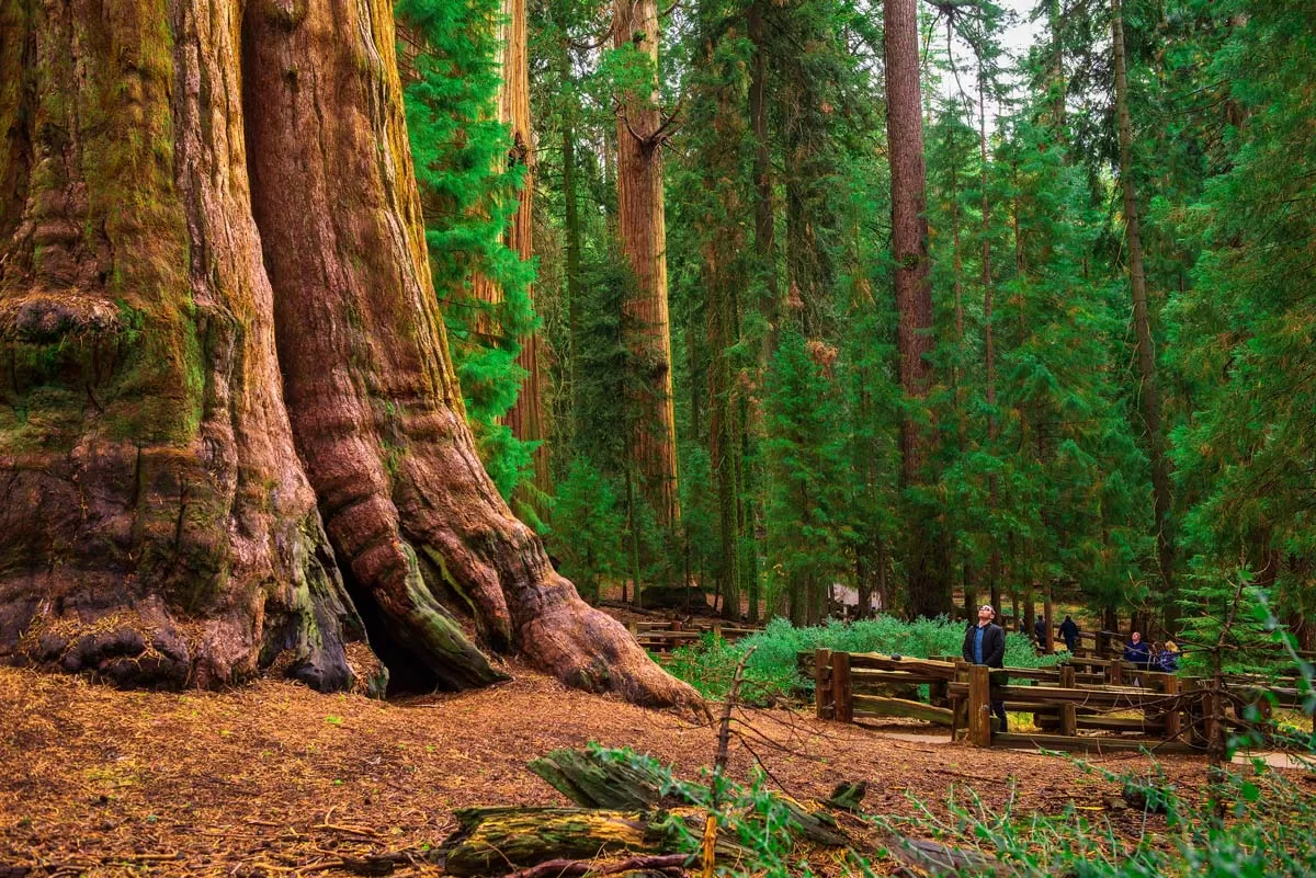
Head to the Giant Forest first thing in the morning, and see General Sherman before the crowds. Enjoy the early morning solitude, with many miles of hiking trails looping under the canopy. You can walk as long or as little as you like: trail options range from 0.25 – 10 miles.
Just be sure to visit General Sherman, located near the start of the trailhead. It’s the world’s largest tree by volume, and the park’s most iconic sight. Parking lot directions.
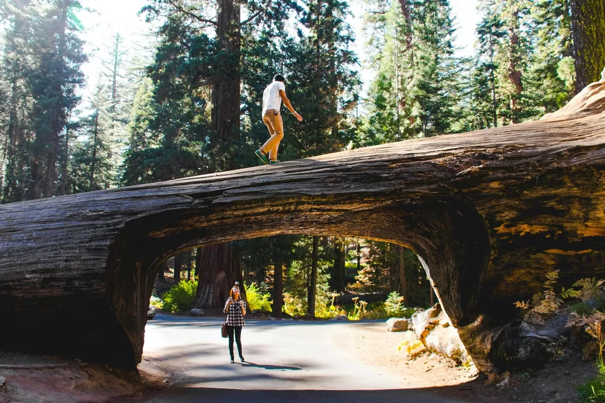
Afterwards, drive through the famous Tunnel Log. Cheesy, yes, but snapping a photo of your car driving through the tree is also a popular “must-do” for many tourists.
Plan to wait in line during the summer months (we’ve witnessed a 30-minute line of cars during peak July travel). Directions.
Admire the biodiversity of the Sierra with stops at Crescent Meadow and Moro Rock. With parking lots adjacent to each other, it’s easy to cross off both popular landmarks in quick order.
The verdant Crescent Meadow comes alive with lush grasses and wildflowers in the spring and summer, while the quick 0.25-mile hike up to Moro Rock rewards with a panoramic view of the valley below.
Directions to both Crescent Meadow parking lot and Moro Rock parking lot.
Day 5: Sierra Backcountry
With an extra day to explore Sequoia at your leisure, we recommend a longer hike for a different perspective of the park.
The High Sierra, an all-encompassing term for the higher elevations of the Sierra Nevada mountains, is renowned for its raw landscapes and jaw-dropping vistas. It often requires a multi-day backpacking trip to reach the true High Sierra, but Sequoia’s unique proximity lets you experience the stark, windswept beauty on a day hike.
Hike the Watchtower Trail. It’s 8.3 miles roundtrip, but this trek is one of the best “deals” in Sierra Nevada hiking.
With short mileage and very manageable elevation gain, the Watchtower gets you to mountain views so epic, they usually require two days of hiking into the backcountry to see. Directions to the trailhead parking lot.
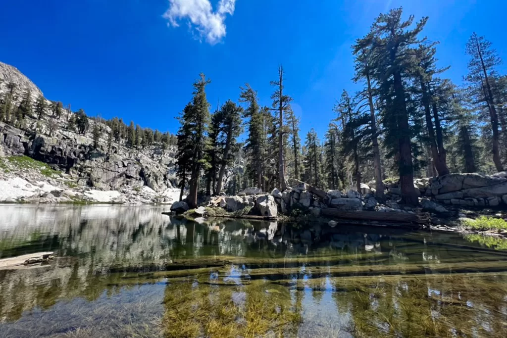
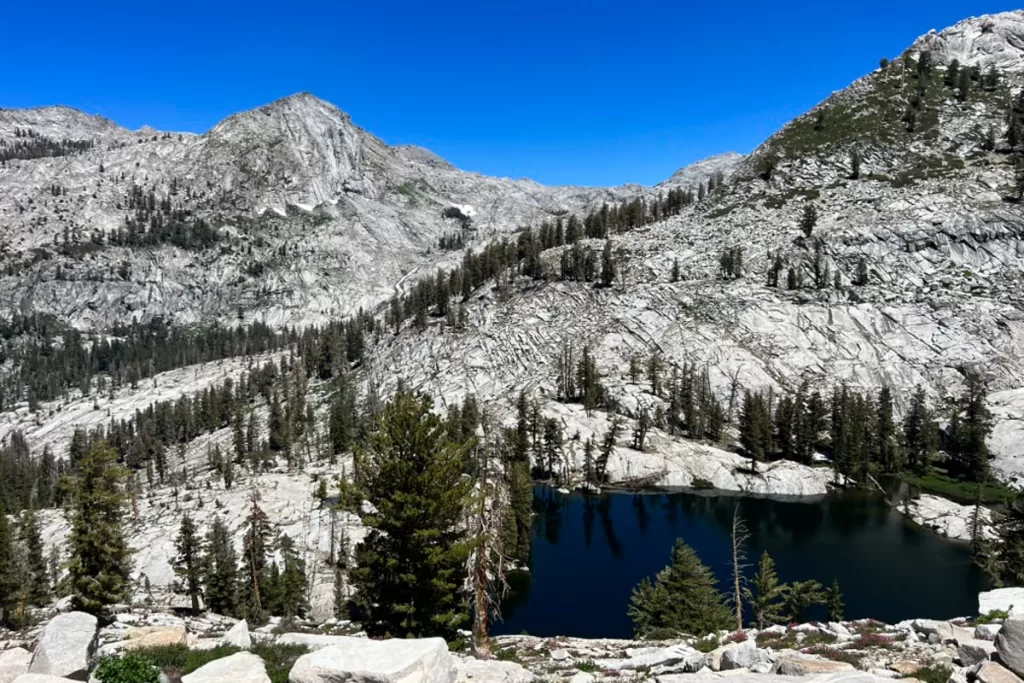
Optional Watchtower Trail Add On: If you’re feeling good, press on another few miles past the Watchtower overlook to a string of crystal alpine lakes.

The Lakes Trail includes Heather Lake (approximately 0.5 mile past the Watchtower), Emerald Lake (1 mile past Heather), or Pear Lake (1 mile past Emerald). You won’t regret lounging on the banks and soaking your weary feet before hitting the trail back to your car.

While sources differ on the total mileage, plan on nearly 13 miles roundtrip if you go all the way to Pear Lake and back.
How to Transit Between Yosemite and SEKI

A quick note on transportation between the parks:
When combining a visit to Yosemite, Sequoia, and Kings Canyon, plan to have a car (whether your own, or a rental). The parks are in remote areas, not well-serviced by public transportation.
While technically you can catch a series of buses between the parks, it’s honestly not worth the effort (driving time between Yosemite and Sequoia is 3 hours by car, or 9—10 hours by bus). Plus, you would still be reliant on shuttles within each park.
Have more time to spend in Yosemite? Check out our guides to the best time of year to visit, the best photo spots, and more.