These easy hikes in Sequoia National Park are a great way to experience the park’s lush sequoia groves and rugged High Sierra backcountry for yourself, but without strenuous effort. These trails all have little to no elevation, with gentle paths over soft terrain.
Jump to:
- Congress Loop (2.9 miles)
- Crescent Meadow (1.5 miles)
- Moro Rock (0.5 miles)
- Eagle View (1.5 miles)
- Big Trees Trail (1.2 miles)
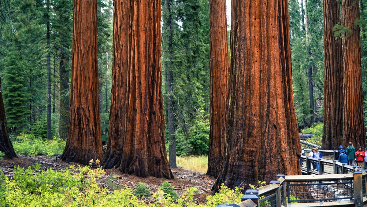
#1. Congress Loop
Distance: 2.9 miles
Elevation Gain: minimal
Best Time to Go: year-round, although there can be snow in winter. Always check current conditions at time of travel.
Trailhead: Directions. (Park at the General Sherman Tree Car Park. On busy weekends, the lot fills up by mid to late morning so plan accordingly).
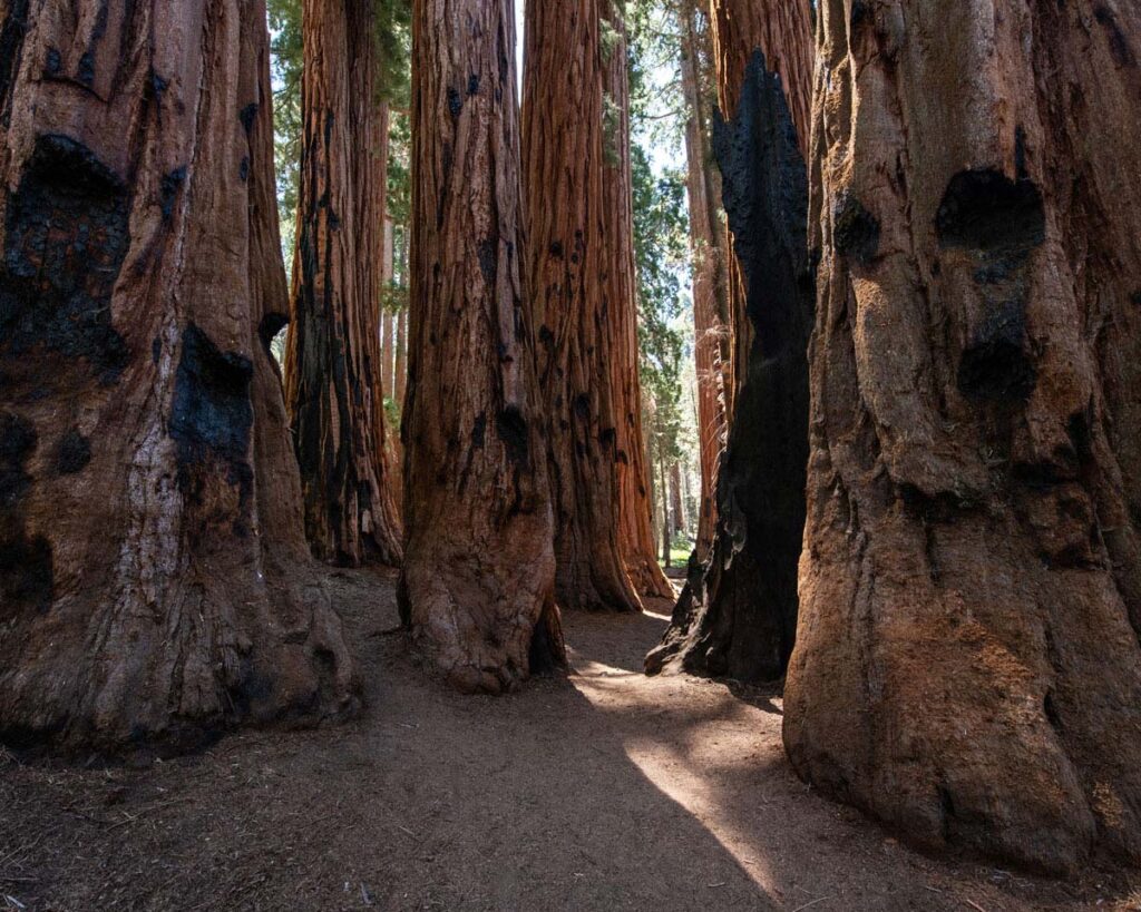
The most popular trail in Sequoia National Park, this paved loop winds through the Giant Forest. You’ll pass many popular landmarks, including the President tree, the Senate grove, and General Lee, but the crown jewel is General Sherman.
Sequoia National Park’s main attraction, General Sherman is the largest tree by volume in the world, and estimated between 2,200 – 2,700 years old.
The only real incline along the loop is about 400 feet, walking back from the trees up to the parking lot. The rest of the trail is essentially flat.
For the best experience, get there early and avoid the crowds. Nothing beats the solitude of early morning, with just the ancient trees for company.
Note: Pay close attention to signage markers. There are close to 10 miles of interwoven footpaths within the Giant Forest, so it’s easy to create a longer hike than you intended, if you’re not watching the wayfinding.
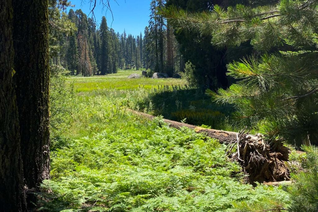
#2. Crescent Meadow
Distance: 1.5 miles
Elevation Gain: minimal
Best Time to Go: year-round, as long as Crescent Meadow Road is open (it closes with snow in winter, and can often be limited to public shuttle on busy holiday weekends). Check current conditions at time of travel.
Trailhead: Directions. Park at the Crescent Meadow parking lot.
Arguably the easiest of all hikes in Sequoia, Crescent Meadow is more of a stroll. However, this postcard-perfect mountain meadow, popular with photographers, is a resplendent field of tall, verdant green grasses, statuesque sequoias, and brightly colored summer wildflowers.
You can walk the perimeter for a gentle 1.5 mile loop over soft terrain, or can take one of multiple add-on trails for some additional mileage.
For a unique add-on, venture to Tharp’s Log: a hollowed-out sequoia tree that was converted into a cabin by early cattlemen in the 1860s. It’s a unique peek into the park’s history, and an easy 1 mile added roundtrip from the Crescent Meadow Loop, for 2.5 miles total.
Tip: Keep an eye out for wildlife in Crescent Meadow. The lush meadow is just as popular with animals, ranging from deer to bears, as it is with humans.
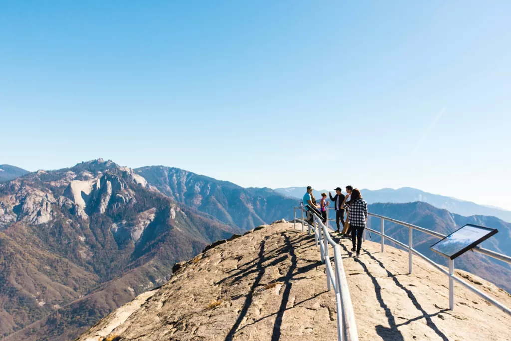
#3. Moro Rock
Distance: 0.5 miles
Elevation Gain: 180 ft.
Best Time to Go: spring, summer, fall. Moro Rock closes in winter with snow. Check current conditions at time of travel, as the road can often be limited to public shuttle on busy holiday weekends.
Trailhead: Directions. Park at the small Moro Rock parking lot.
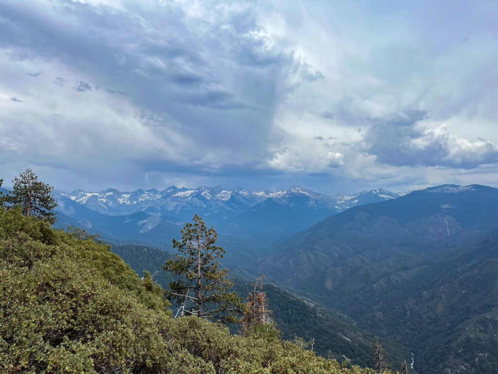
A quick hop from Crescent Meadow, this short scramble up to the top of Moro Rock rewards with 360-degree views of the valley below, stretching from the Great Western Divide in the east to the farm towns of the Central Valley in the west.
#4. Eagle View
Distance: 1.5 miles
Elevation Gain: 300 ft.
Best Time to Go: year-round, as long as Crescent Meadow Road is open (it closes with snow in winter, and can often be limited to public shuttle on busy holiday weekends). Check current conditions at time of travel.
Trailhead: Directions. Park at the Crescent Meadow parking lot.
Curious what the famed High Sierra Trail looks like? Eagle View gives you a brief glimpse into the popular 72-mile backpacking trail, which starts at Crescent Meadow and ends on Mount Whitney.
With a quick out-and-back to Eagle View, you’ll be able to admire the Great Western Divide (which delineates the watershed direction of rivers in the Sierra Nevada).
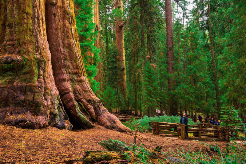
#5. Big Trees Trail
Distance: 1.2 miles
Elevation Gain: 100 ft.
Best Time to Go: year-round, although there can be snow in winter. Always check current conditions at time of travel.
Trailhead: Directions. Park at the Giant Forest Museum lot.
For a different perspective of the Giant Forest, this easy loop hugs Round Meadow for just 100 feet total of elevation change.
Along the trek, you’ll cross Little Deer Creek on a quaint wooden footbridge, pass Clara Barton (named after the founder of the American Red Cross), and witness the quirky Ed by Ned – two sequoias that actually fused together over time.
To access the Big Trees Trail, park at the Giant Forest Museum. (While you’re there, take some time to pop inside and learn more about these incredible natural wonders – you’ll appreciate the ancient behemoths that much more while you’re on the trail).
Finished the easy hikes in Sequoia and looking for a bigger challenge? Check out our recommendations for the park’s best moderate hikes.