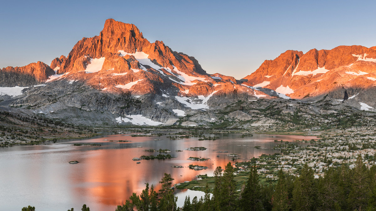
The loop encompassing Thousand Island Lake and Ediza Lake is one of the most popular backpacking trips in the eastern Sierra. Over 22.6 miles, it traverses jaw-dropping vistas, including serene alpine lakes, dappled forests, and the jagged, epic peaks the eastern Sierra are deservedly famous for.
For most of the trip, you’ll also follow the John Muir Trail and Pacific Crest Trail, offering a fun peek into these two famous long-distance trails.
Distance: 22.6 miles roundtrip
Recommended Time: 3 days, 2 nights
Elevation: 1,500 ft. cumulative gain
Permit Required: Yes, year-round. Quotas in effect May 1 - Nov. 1.
Jump to:
- Itinerary Overview
- Itinerary Options
- Permits
- Preparation: What to Pack and Where to Stay the Night Before
- Location and Trailhead
- Itinerary: Ediza Lake and Thousand Island Lake Loop
- Camping and Safety Notes
Itinerary Overview
There are (3) different trails you can take, to accomplish this loop: High Trail, River Trail, or Shadow Creek Trail.
While the High Trail is the most famous of the three, it is also an unforgiving ascent. The trail is completely exposed, with nonstop elevation gain over 7.8 miles.
Instead, we recommend starting along the trail less traveled: in this case, Shadow Creek. Shadow Creek is a more shaded route, ascending more gradually through dappled pine forests and along peaceful mountain streams and lakes. Then, you can take the High Trail on the way out, when it’s mostly downhill.
(Additionally, we think the views are better in this direction, entering via Shadow Creek and exiting via the High Trail…)
Regardless of which trail you take in, we recommend taking a different trail out, for variety.
Itinerary Options
There are (3) route options you can take, to accomplish the Thousand Island Lake and Ediza Lake loop:
- Enter via Shadow Creek Trail, exit via High Trail or River Trail
- Enter via High Trail, exit via Shadow Creek Trail or River Trail
- Enter via River Trail, exit via High Trail or Shadow Creek Trail
Keep in mind that overnight permits are in high demand during quota season (May 1 – Nov. 1), and as a result, you may not have a choice of which trail you follow. You might just have to take whichever route you can successfully snag permits for.
Permits for Thousand Island Lake and Ediza Lake
This loop cuts through the Ansel Adams Wilderness and Inyo National Forest, which require permits year-round.
When choosing a permit, it only matters which trail you start on (this is how they track quotas). You can exit via whichever trail you prefer.
Road Closures: Due to ongoing road work, in 2024-25 the trailhead was only accessible Fridays – Sundays. The project is expected to be completed in time for the 2026 season, but there is always a chance of delays; you can check current conditions on the Reds Meadow Reconstruction page.
How to Get a Permit
Permits are available via recreation.gov. Simply head to the Inyo National Forest Wilderness Permits page and select “Explore Available Permits” in the top-right box.
During the high season (May 1 – Nov. 1 each year), quotas are in effect to minimize crowds. There are (90) permits available any given day — 30 for each of the three trail options: High, River, and Shadow Creek.
60% of each trail (or 18 total) are released at 7 a.m. PST, 6 months out from your start date. The other 40% (12 total) are released at 7 a.m. PST, 2 weeks from the start date.
As with most popular trails and overnight permits, this route is in extremely high demand, and permits usually get booked up instantaneously. Plan to be online at 6:59 a.m., to grab your desired route as soon as the clock hits 7:00.
Once you get a permit, you’ll be asked to select your “exit” trail during the check-out process. Again, it doesn’t matter which trail you exit, as these don’t count against the quotas. But you should still have a choice in mind, so you can accurately log it during your order confirmation.
Permits must be printed at home during the week preceding the start of your trip. If you do not physically print your permit, it may be re-released back into the portal.
Note: outside of quota season (Nov. 2 – Apr. 30), permit availability is unlimited. However, only the most skilled mountaineers should consider going during this window, when the Sierra winter is unrelenting.
Preparation: What to Pack and Where to Stay the Night Before
What to Pack for Thousand Island Lake and Ediza Lake
Besides the standard backpacking essentials, a few quick notes on how to prepare for this specific trail:
- Warm Clothing: Being the eastern Sierra, temperature swings can be much more dramatic than the range’s gentler western slopes. Even in the height of summer, temps easily drop to 40 degrees at night, with wind gusts chilling further. Plan to carry warm layers for the evening.
- Bear Canisters: Portable bear canisters are mandatory for overnight trips into Inyo National Forest. If you don’t own one, you can rent from REI or similar stores.
- Water Filters: While water sources are prevalent along most of the trail, you will need to filter all water to make it safe for drinking. We personally like the LifeStraw gravity filter, but any quality water filter will do (the Katadyn gravity filter is a close second).
- Water Shoes: Admittedly a luxury rather than a must-have, but lightweight water shoes come in handy on this route. To get to the camping section of Lake Ediza, the easiest and safest route is to ford the stream (more on that below). Swapping your hiking boots at this point for water shoes will get you across, quickly and painlessly. Xero Sandals hold up well with excellent grip on submerged rocks, but any quality water shoe will do. You’ll also appreciate them when lounging on the banks of the many lakes along the way.
- Insects: Here, weather conditions will dictate how bad the insects are. We’ve always been lucky hiking this stretch, where frequent breezes and winds have kept the bugs to a minimum. However, we’ve heard rumors of bad mosquito levels if the air gets flat enough. Plan for bugs, and hopefully you’ll be pleasantly surprised.
You can also check out our backpacking packing list guide, which includes a downloadable PDF packing checklist, along with tips, hacks, and other recommendations.
Where to Stay the Night Before
Mammoth Lakes is the closest town to the trailhead (about a 10-minute drive from Agnew Meadows), and offers numerous lodging options via hotels, vacation rentals, and campsites. You can also find cheaper hotels further down Highway 395 in Bishop (approximately a 1-hour drive).
Location and Trailhead
The Thousand Island and Lake Ediza loop starts and ends at Agnew Meadows. In normal years, there is a small parking lot where you can leave your car.
if you’d rather not leave your car overnight, you can also catch the Reds Meadow Shuttle. The shuttle picks up at two locations: the Village at Mammoth Lakes and, closer to Agnew Meadows, the Mammoth Mountain Inn/Adventure Center. Roundtrip tickets are $15, and can be purchased either online or at the Mammoth Mountain Adventure Center.
When the trailhead opens each weekend, the first available shuttle departs Mammoth Mountain Inn at 9 a.m. on Friday mornings. We strongly recommend getting in line by 7:45 a.m., as the line will be wrapped around the block by 8:30.
Road Closure Note: In 2025, ongoing construction closed the parking lot, and it was mandatory to take the shuttle to and from the trailhead. Construction is expected to conclude before summer 2026, but we recommend checking the Reds Meadow Reconstruction website for current conditions, in case of delays.
Itinerary: Ediza Lake and Thousand Island Lake Loop
This itinerary follows our recommended route, entering via the Shadow Creek Trail and exiting via the High Trail. However, it can easily be reversed.
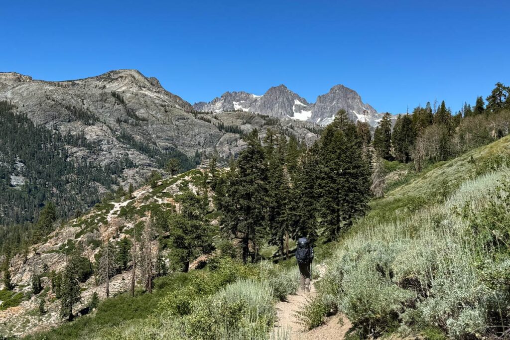
Day #1: Agnew Meadows to Lake Ediza (7.4 mi, 1,000’ elevation gain)
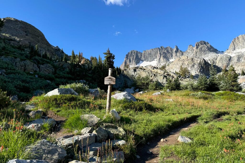
At the Agnew Meadows trailhead, follow the small marker that points the way to Shadow Creek. Water sources will be plentiful today, particularly the second half.
During this initial stretch, you’ll meander along a flat, shaded trail before coming to a junction of the Pacific Crest Trail. Follow the sign to the right to stay on the Shadow Creek Trail.
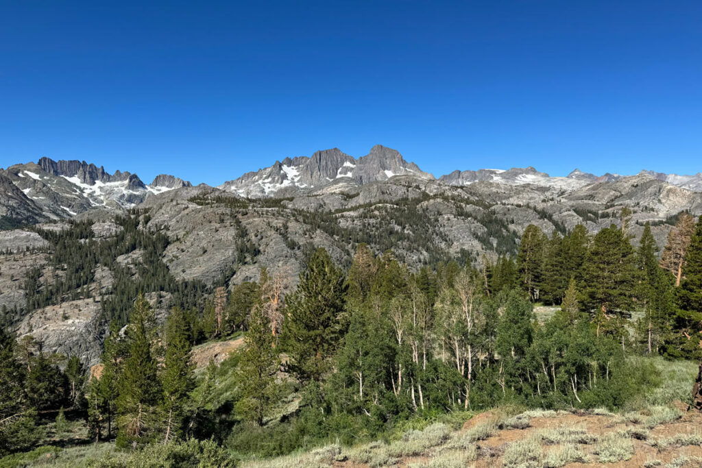
About 1.5 mi. in, the trail opens up to the first vistas you’ll see today. You’ll hug an exposed ridge line for a stretch, before dropping back into the shade of dusty pine forest to Olaine Lake.
Olaine is a serene little spot, tucked back against the mountains. Follow the trail along the length of the lake. At the far side, you’ll stay left at the fork to continue on the Shadow Creek trail.
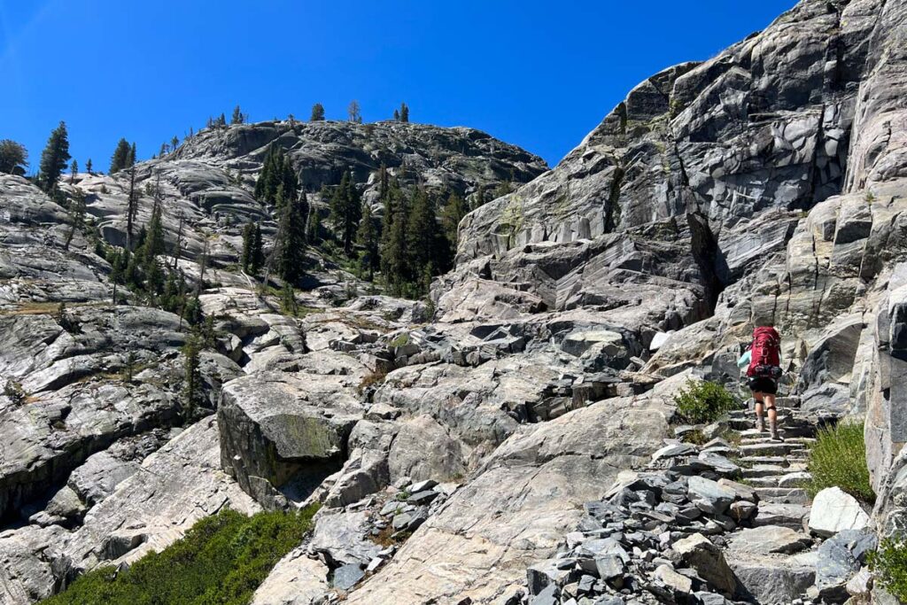
Once you cross the bridge over the middle fork of the San Joaquin River, you’ll immediately hit the biggest climb of the day. It’s 700 ft. of gain in just over a mile, along a series of switchbacks up the exposed granite flank. However, this chunk makes up the majority of your elevation gain today. Put your head down, grind it out, and it’ll be behind you before you know it. As you climb, remember to keep looking behind you — you’ll have beautiful views back towards Agnew Meadows and Mammoth.
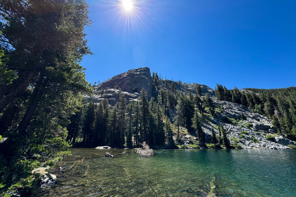
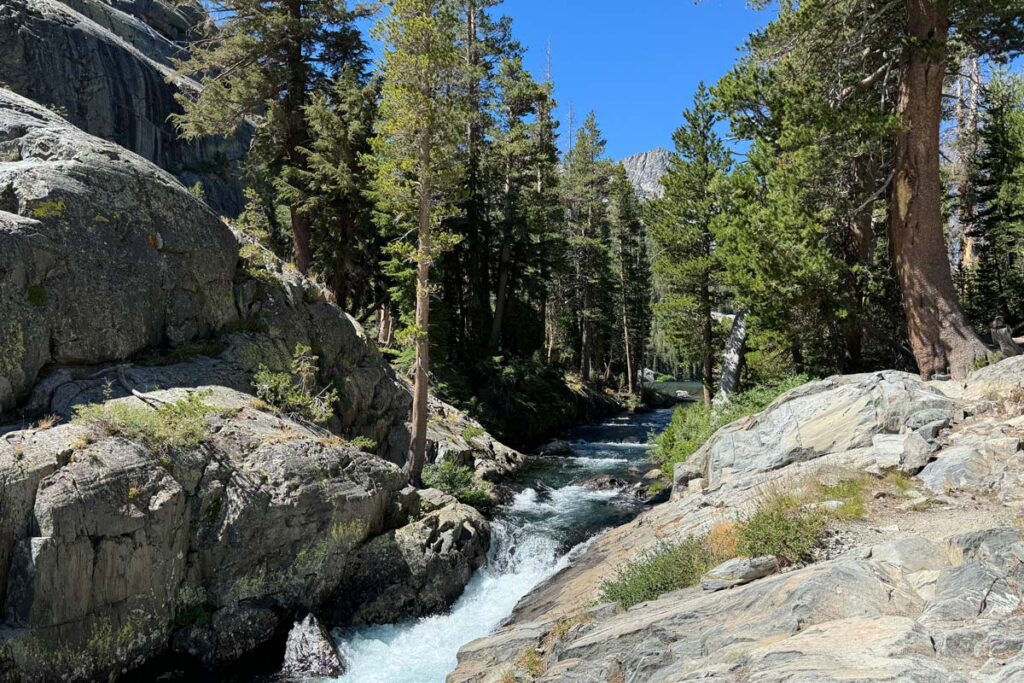
At the end of the climb, a series of stone stairs will lead you past a roaring little waterfall and the output of Shadow Lake. Shadow is a stunning little gem, with gentle lapping shores and crystal-clear waters. It’s a perfect spot to rest, dip your feet, and celebrate the worst elevation gain being behind you.
Past Shadow Lake, the trail doubles as the John Muir Trail. Follow the signs denoting the JMT (although someone has helpfully scrawled “Ediza” next to the JMT on some of the signposts, to minimize confusion).
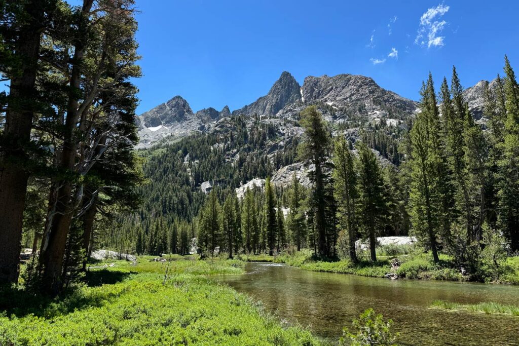
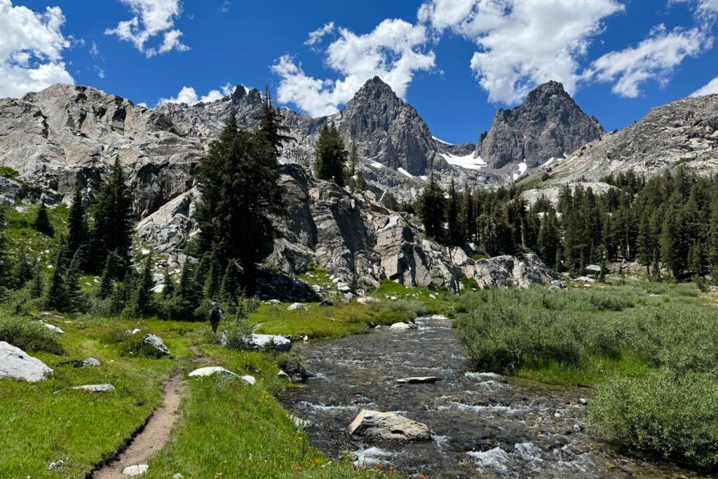
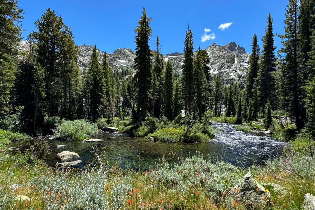
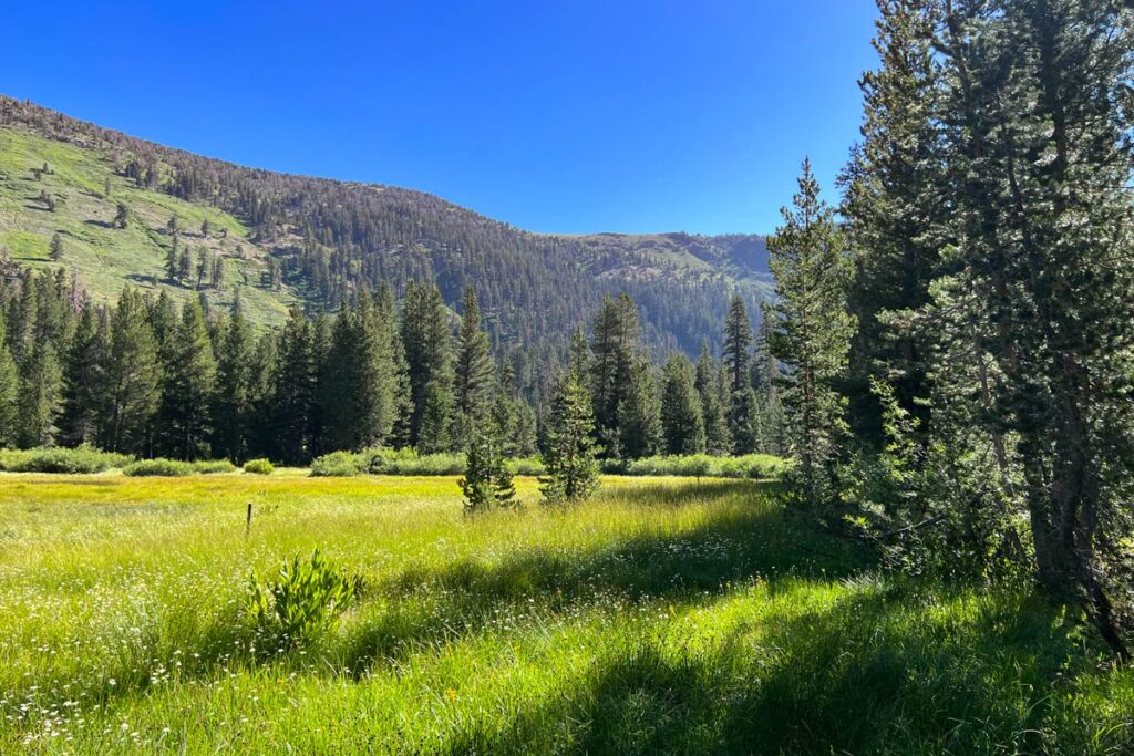
For the rest of today, the trail winds along Shadow Creek. The path is mostly even, with only small portions of incline. In the summer months, it’s verdant and covered with cheerful wildflowers, making for a delightfully bucolic ramble.
0.9 miles past Shadow Lake, you’ll break off from the JMT and follow the Shadow Creek trail the rest of the way.
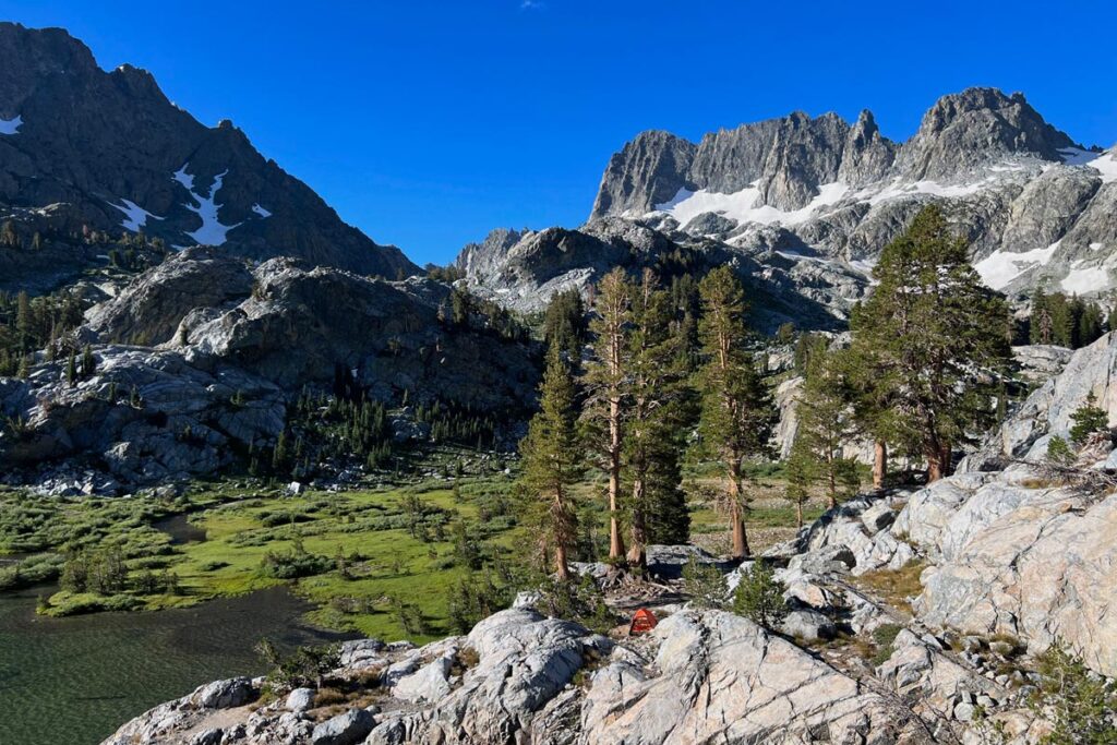
About 2.2 miles past Shadow Lake, you’ll have a brief climb up exposed granite stairs, before the trail again returns to shaded woodland. Once you reach a log bridge, this is the sign that Ediza Lake is just around the corner.
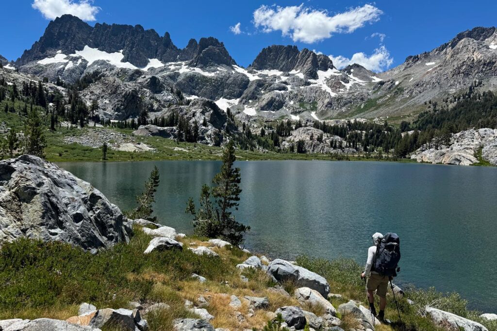
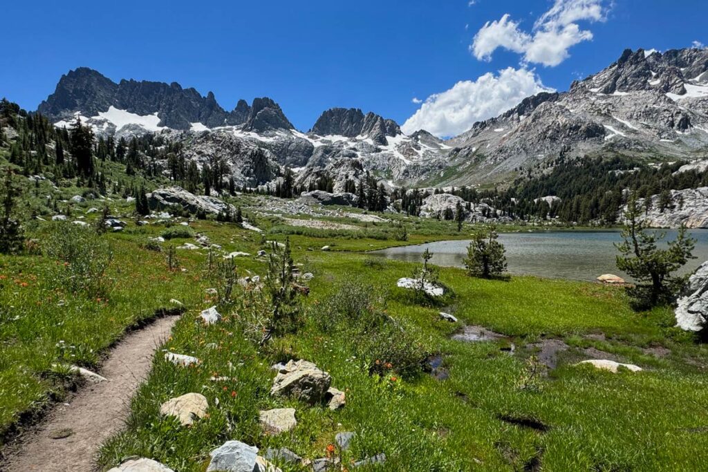
After one last quick staircase, you’ll come around the bend to some of the most dazzling alpine scenery imaginable. Words cannot do justice to the splendor (most people audibly gasp, the first time they see Ediza Lake).
Optional Add-On: Iceberg Lake

If you want to add on Iceberg Lake (approximately 1 mile beyond Ediza Lake), you’ll break off from the main trail about halfway around Ediza. Follow the sign to Iceberg Lake, up the hill to the left.

We recommend doing it on the way, as you most likely won’t feel like backtracking if you wait until after you’ve set up camp at Ediza. Camping is also available at Iceberg Lake.
To get to Ediza’s designated camping area (on the west and north shores), you’ll need to walk the circumference of the lake. Simply follow the footpath the hugs the shoreline. There are two river crossings necessary here. The first is an easy hop across a series of rocks, as Shadow Creek empties into Ediza Lake.
However, the second river crossing is a bit sketchier, and involves navigating an often fast-flowing current. If you keep following the footpath around Ediza Lake, you’ll come to this second crossing as the trail begins to climb up the hill, at the base of the peaks.
Instead, we strongly recommend wading across the stream earlier, closer to the open meadow and plain where the current is much softer. You’ll reach the far bank and need to cross the plain off trail, before picking the path back up by the rocky knoll on the far side (as shown below). This tip was recommended to us by a park ranger, and saved a lot of effort.
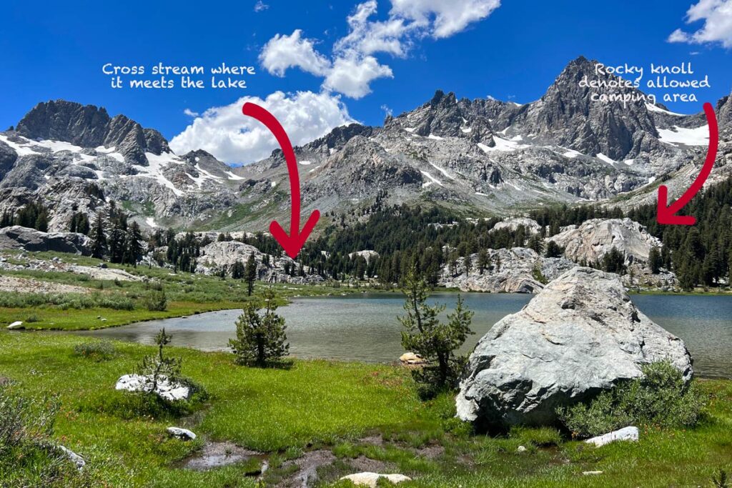
The knoll serves as the unofficial designation of where you can begin choosing a campsite. Take some time to explore and find your preferred home base: the first sites you reach are more protected, set back into the vegetation, or you can continue further for more exposed sites with better views.
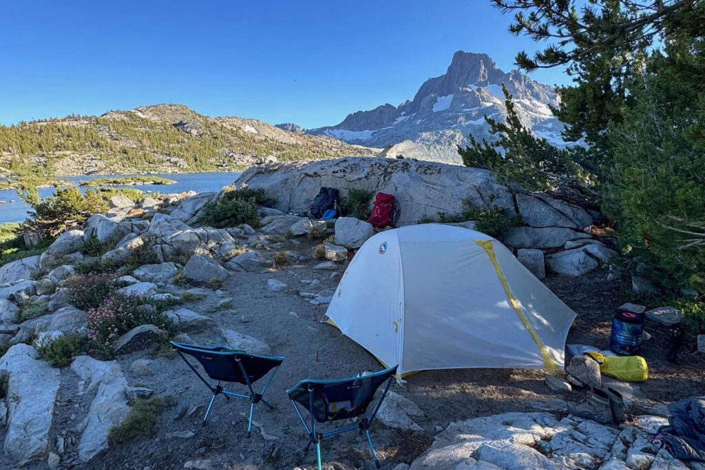
Day #2: Ediza Lake to Thousand Island Lake, 7.4 miles, 1,400’ elevation gain
This morning, you’ll begin by retracing your steps, back the way you came, 2.3 miles to the junction with the John Muir Trail. It’s a pretty view, with dappled early-morning sunlight through the trees, and provides a serene warmup to the day ahead.
Once you reach the JMT junction, you won’t have water sources for the next (grinding) 2.5 miles, so we recommend ensuring you have a full supply before starting your day.
Today’s stretch from the JMT junction to the pass before Garnet Lake is your longest elevation gain of the three-day loop, climbing 1,000 ft in 2.5 miles. While it’s not a blistering ascent, it is constant, with a few steeper sections in the middle of the stretch.
The elevation gain alternates between exposed shale and more open pine forest, so aim to get past this stretch before the heat of the day builds. The trail levels out at the tree line, before one last little push, about 200 yards, up to the ridge of the pass.
Heading down the back side of the pass, you’ll traverse a series of winding switchbacks, down to the shores of Garnet Lake. You’ll follow the lake, hugging the eastern side up to a wooden bridge above the outlet, before cutting back west along the far shore. Expect more elevation gain here (approximately 350 ft.), as shale switchbacks wind upwards, but the incline is reasonable. This begins another stretch without a water source, so make sure you aren’t running low before you leave Garnet Lake.
About 1.3 miles down, you’ll come to Ruby Lake. There’s not much here, and you’re on the home stretch for today, so it’s best to push on. Less than 0.75 miles further down from Ruby Lake is Emerald Lake. At higher elevation, it’s mostly barren and windswept here, although there’s a small grove of trees on the far side of Emerald Lake if you desire a break.
Up and over one final hill past Emerald Lake, Thousand Island Lake comes into sight. You’ll descend down to the lakeside trail, which meanders over 2.5 miles, the length of the lake. Go as far as you want, to find your desired campsite.
Camping at Thousand Island Lake: being a popular spot along both the JMT and PCT, camping at Thousand Island Lake can get crowded by backcountry standards, with sites often interspersed at just 25 – 50-yard intervals during high season weekends.

We recommend getting to Thousand Island Lake by 1 p.m. at the latest, to snag a good spot. Winds often whip through the passes, and you’ll also want to consider protection from the elements when choosing a campsite.
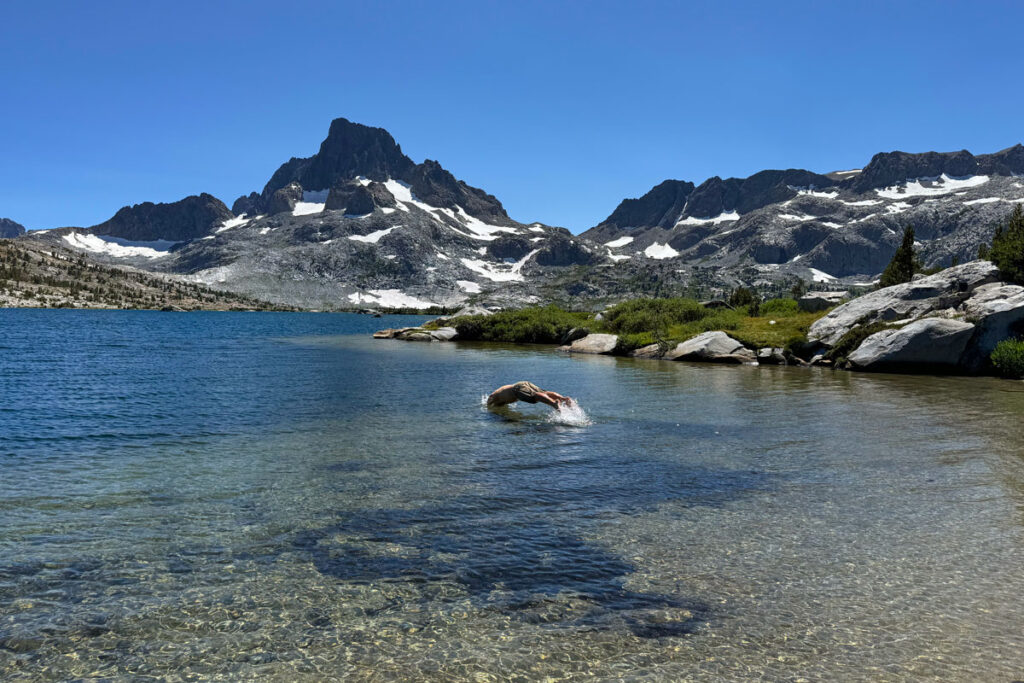
Once you set up camp, enjoy a “beach day” on the shores of the lake. In the summer months, the shallows are often warm enough (by alpine lake standards) to take a refreshing, well-deserved dip before you laze on the sunny banks and while away the afternoon.
Day #3: Thousand Island Lake to Agnew Meadows, 7.8 miles, 200′ elevation gain and 1,500’ loss
On your final day, you can either return to Agnew Meadows via the Shadow Creek trail, or take a more direct route on the River or High Trail.
In the past, we’ve opted for the High Trail, as it’s one of the more well-known routes and doubles as the Pacific Crest Trail. But the River Trail parallels the High Trail for most of the way, with similar mileage. When picking a route, the River Trail is a bit more shaded, while the High Trail has more dramatic vistas — you can choose accordingly.
Note: water sources are infrequent, and it’s best to not expect to have any refill stations. Plan to fill up in full today, before departing Thousand Island Lake.
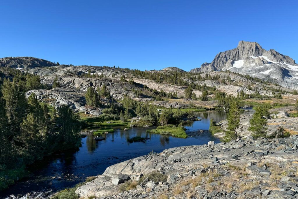
Regardless of whether you take the High Trail or River Trail, you’ll follow the PCT signs out of Thousand Island Lake on the northeast side. The path cuts along the ridge line, looking down on a series of small high alpine lakes — a stunning vista, as the lakes sparkle in the early morning sunshine.
Approximately 1 mile down, you’ll come to the River Trail junction. Those returning via River will (obviously) veer off, while those taking the High Trail will continue along the PCT route.
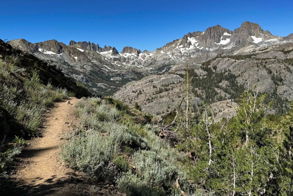
For the next few miles, you’ll gently wind down into a more forested stretch. There’s a short, brief uphill burst to a ridge, before you descend back into tree cover.
Along the way, regular trail markers will break up the monotony. Stay on the PCT and don’t take any of the break-off points, but the signs will help mark your progress: from the River Trail junction, it’s 0.4 miles to the Clark Lake sign, another 0.2 miles to Badger Lake, 0.3 to Summit Lake, and 0.7 to another Clark Lake trail.
From here, it’s a straight shot: 5.2 miles back to Agnew Meadows. This also signifies the stretch of today’s trail that has elevation gain, as it climbs up the ridge. Once you pass the second Clark Lake sign, you’ll climb 250 ft. in elevation. In the summer months, the trail can become more of a trickling creek bed, but nothing you can’t just splash through in hiking boots.
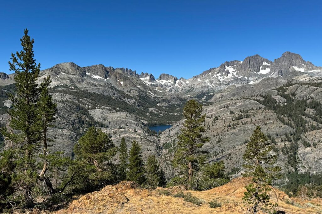
The climb isn’t dramatic, but it’s steady, and it’s hard not to feel impatient on your final day, without tree cover to keep things cool. However, once you get even with Shadow Lake across the valley (which is a monumental visual of how far you’ve come from day #1!), the trail levels out along the ridge line.
You’ll have a few more pockets of elevation gain here and there, before you begin descending back into the valley. But the jaw-dropping expanse of peaks in both directions, looking out to Mount Ritter and down to Mammoth, is enough to keep you distracted. The views are epic, and better in this direction than if you had taken the High Trail in on day #1, when they would have been behind you.
With about 2.5 miles to go, you’ll see a grove of trees come into focus along the ridge. This signifies the start of your final descent. At first, it’s fairly moderate as the trail cuts down through wooded stretches. You’ll conclude with one last series of switchbacks, dropping 500 ft. fairly rapidly, that will deposit you back where it all started, at Agnew Meadows.
Camping and Safety Notes
Choosing a Campsite
There are a few limitations in effect on this loop, to keep in mind when selecting a campsite:
- Ediza Lake: camping is only permitted on the north and west sides of the lake (the farthest points from where you enter)
- Thousand Island Lake and Garnet Lake: no camping within 0.25 mile of the outlet of the lake
- Shadow Lake: camping is not permitted at the lake, nor between Shadow Creek and the trail
Remember the 100 Foot Rule
Additionally, common trail courtesies are always in effect. While the vast majority of people are thoughtful and responsible, we’ve witnessed a few individuals breaking the unspoken trail rules, so a quick refresher bears repeating:
- Campsites: should always be 100 feet or more away from any water source, as well as 100 feet or more from the trail.
- Cleaning: never wash your dishes or dump soapy water within 100 feet of water sources.
- Human Waste: don’t relieve yourself (either liquid or solid) within 100 feet of water sources. Additionally, please always pack out your toilet paper! If you bury it, animals will often dig it up, and then rangers have to come through and clean up the mess.
Wildlife Along Thousand Island Lake and Ediza Lake
The eastern Sierra is a vibrant ecosystem, and you’ll be sharing the trail with all of its other residents, including bears, coyotes, snakes, deer, and more.
Always take proper precautions to secure all scented items within your bear canister, and don’t leave food unattended.
Note: as of 2024, there’s a resident coyote at Thousand Island Lake who habitually steals unattended food. We heard of one group who turned their back for 5 minutes to let their dinner cool before eating, only to find it gone.
Inclement Weather and Fire Safety
As with any trip into nature, always check the weather forecast before you depart, and talk with a ranger for further info. Wildfires can also be common in the Sierra during the summer months (usually picking up in August). Familiarize yourself with current blazes at the interactive Cal Fire Incident Map.
Always bring a GPS when going into the backcountry. These handy devices help expedite search and rescue should you get injured, lost, or otherwise trapped.
We personally like the Garmin inReach Mini. It’s tiny, has an SOS button to alert rescuers of your location, and even lets friends and family back home watch your progress. The Garmin inReach is pricey – typically running $400. However, you can sometimes find Amazon resellers posting it in the $250 range, along with many other cheaper options.