Having completed nearly all of the main trails over the years, we’ve compiled the following list of recommendations for the six best easy hikes in Yosemite.
Mostly flat, these trails are a great way for young children or those with limited mobility to still experience Yosemite’s marvels. For not much effort, you’ll still get up close to the park’s resplendent valleys, jaw-dropping vistas, and even North America’s tallest waterfall.
Note: Yosemite requires reservations for entry at various points during the year, including February Firefall and summer peak season. Always check the current reservation requirements for the dates you plan to visit.
Jump to:
- Lower Yosemite Falls (1.2 miles)
- Meadow Loop Trail (2.0 miles)
- Glacier Point Trail (0.6 miles)
- Taft Point (2.2 miles)
- Soda Springs and Parsons Lodge Trail (1.4 miles)
- Mariposa Grove: Big Trees Loop (0.3 miles) or Grizzly Giant Loop (2 miles)
#1. Lower Yosemite Falls
Distance: 1.2 miles
Elevation Gain: minimal
Best Time to Go: year-round, although April – June has the most powerful falls, with water flow peaking in May. Always check local conditions at time of travel.
Trailhead: Directions. It’s easiest to park in the Yosemite Falls parking lot, just beyond Camp 4.
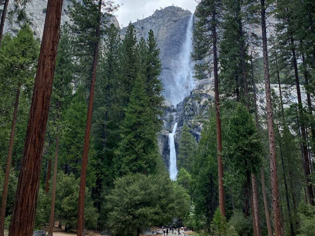
Arguably the most popular of all easy hikes in Yosemite, this paved trail leads you through tall pines to the base of North America’s tallest waterfall.
At 2,425 feet, the falls roar with icy snowmelt tumbling from the high Sierra to the valley below. Peak waterfall season is late spring (April – June), but you can still catch the cascade any time of year.
#2. Sentinel and Cook’s Meadow Loop Trail
Distance: 2.0 miles
Elevation Gain: minimal
Best Time to Go: year-round. Always check local conditions at time of travel.
Trailhead: Directions. Although you can pick up the trail from any of the valley’s designated parking lots, including the Yosemite Falls Vantage Point lot.
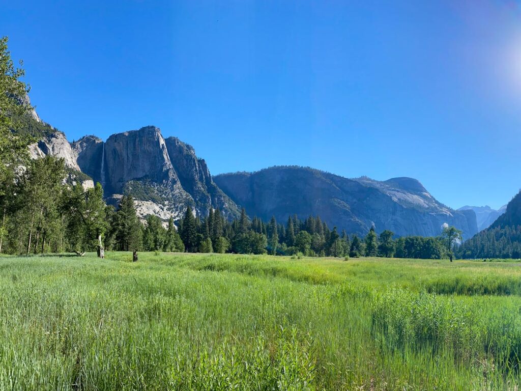
Another paved trail, the Meadow Loop immerses you in the splendor of Yosemite Valley without any effort.
You’ll wind through tall groves of fir and pine, cross stone bridges over the rippling Merced River, and stroll raised boardwalks through the tall grasses of mountain meadows.
Additionally, the loop offers prime views of El Capitan, Half Dome, Lower Yosemite Falls and Bridalveil Falls.
#3. Glacier Point Trail
Distance: 0.6 miles
Elevation Gain: minimal
Best Time to Go: whenever Glacier Point Road is open. Check local conditions, as it usually closes in winter due to snow.
Trailhead: Directions. Park in the paved Glacier Point lot.
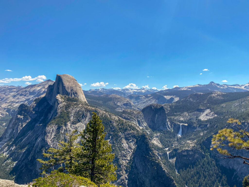
Glacier Point is one of our favorite views in all of Yosemite. You get a front-row seat to Half Dome and Nevada Falls, with miles of Sierra peaks stretching behind them, as far as the eye can see.
There is a paved footpath that leads to various vantage points along the ridge, with Half Dome appearing so close you can almost reach out and touch it.
It’s about a 45 minute drive from Yosemite Valley (either via car or the public Glacier Point tour bus).
#4. Taft Point
Distance: 2.2 miles
Elevation Gain: 350 ft.
Best Time to Go: whenever Glacier Point Road is open. Check local conditions, as it usually closes in winter due to snow.
Trailhead: Directions. If the parking lot is full, park along the shoulder of Glacier Point Road.
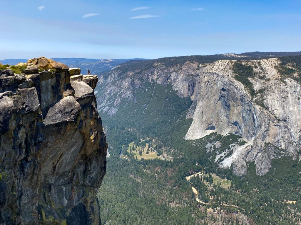
Taft Point is the famous vertigo-inducing lookout spot on the way to Glacier Point. From the trailhead, it’s an easy 1 mile-ish stroll to the edge, where the most daring can look down on the valley below.
Even those afraid of heights can still peek epic views from a safe distance back, catching sight of El Capitan and Yosemite Falls.
#5. Soda Springs and Parsons Lodge Trail
Distance: 1.4 miles
Elevation Gain: minimal
Best Time to Go: whenever Tioga Road is open. Check local conditions, as it usually closes in winter due to snow.
Trailhead: Directions. Plan to park along the shoulder of Tioga Road.
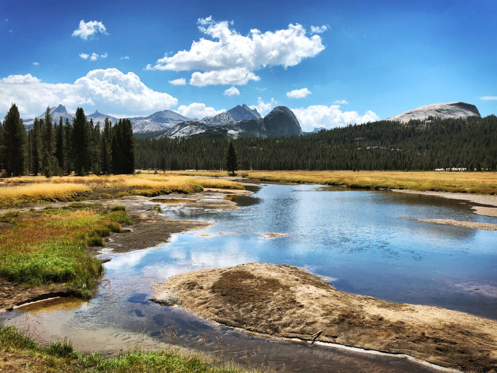
Soda Springs allows you to experience the biodiversity of Tuolumne Meadows and the high country, with rugged landscapes very different from Yosemite Valley.
Up at this elevation, trees are scarcer, but the open meadows with the meandering Tuolumne River and sharp mountain peaks behind are no less beautiful than the valley below.
#6. Mariposa Grove: Big Trees Loop or Grizzly Giant Loop
Distance: 0.3 miles (Big Trees Loop) or 2.0 miles (Grizzly Giant Loop)
Elevation Gain: 380 ft.
Best Time to Go: open year-round. However, Mariposa Grove Road is closed in winter, at which point the grove is only accessible via hiking, snowshoeing, or skiing. Check local conditions.
Trailhead: park at the Mariposa Grove Welcome Area and take the free shuttle to the trailhead. However, those with a disabled placard can drive as far as the Grizzly Giant parking.
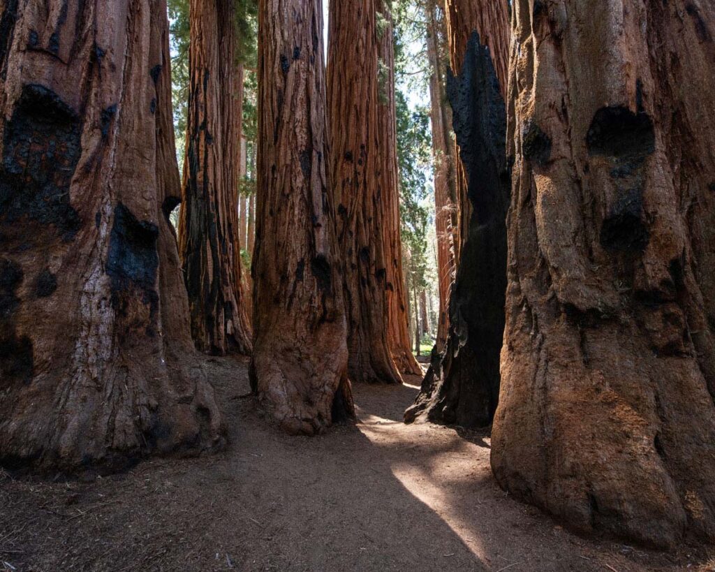
Either the Big Trees Loop or Grizzly Giant Loop gets you up close and personal with the famed giant sequoias of Mariposa Grove.
The Big Trees Loop is flat enough to be wheelchair accessible, while those looking for a slightly longer stroll can opt for the Grizzly Giant Loop (300 feet of elevation gain, but nothing too strenuous).
If you’re ready for more of a challenge, check out our recommendations for Yosemite’s best moderate and hard trails.
