For the avid adventurer, Yosemite offers unparalleled vistas and pristine backcountry. These hard hikes in Yosemite will immerse you in some of the most spectacular scenery imaginable.
Having completed nearly all of the park’s main trails over the years, we’ve compiled the following list of the five best challenging hikes within the park’s boundaries. And while you don’t need to have mountaineering skills to conquer any of the trails below, you should be in decent physical fitness.
Note: Yosemite requires reservations for entry at various points during the year, including February Firefall and summer peak season. Always check the current reservation requirements for the dates you plan to visit.
Jump to:
- Glacier Point to Yosemite Valley (8.6 miles)
- Cathedral Lakes (8.6 miles)
- Clouds Rest (12.2 miles)
- Upper Yosemite Falls (6.6 miles)
- Half Dome (16.5 miles)
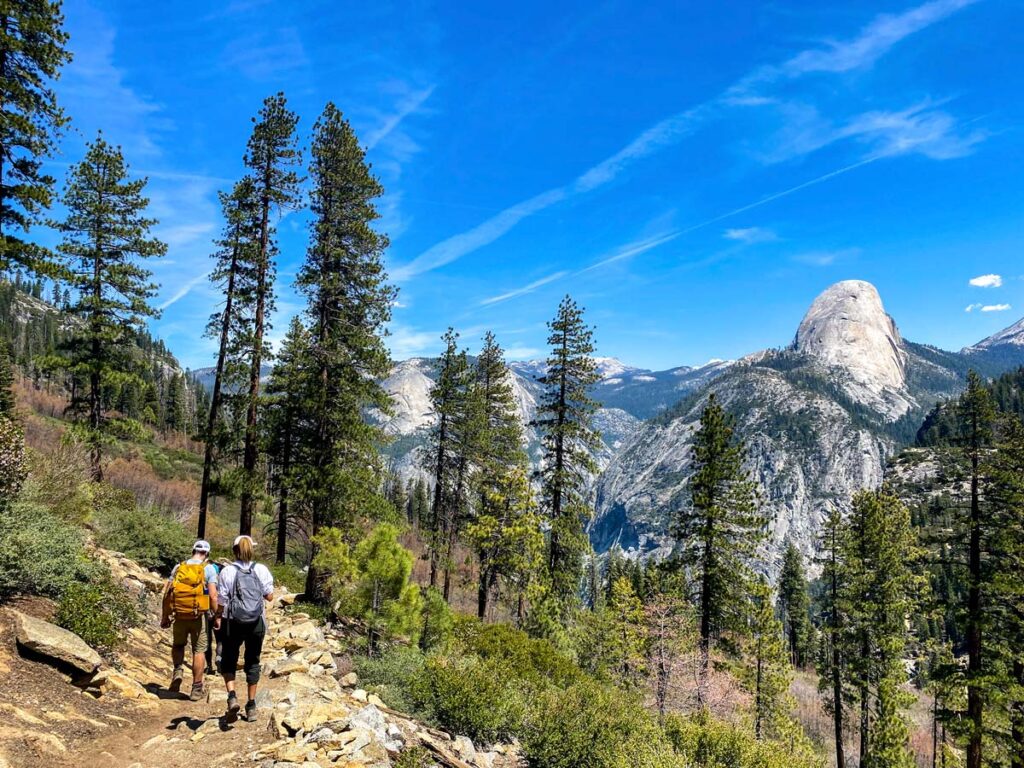
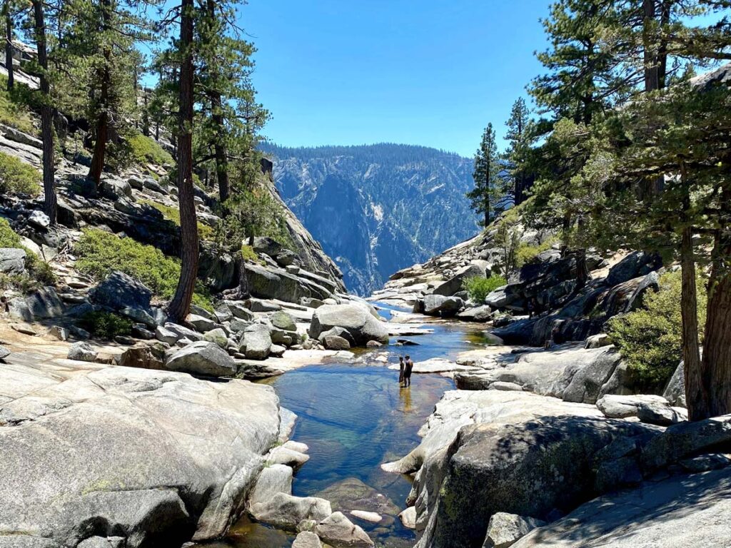
#1. Glacier Point to Yosemite Valley Trail
Distance: 8.6 miles roundtrip
Elevation Gain: 980 ft.
Best Time to Go: whenever Glacier Point Road is open. Check local conditions, as it usually closes in winter due to snow.
Trailhead: Directions. Being a point-to-point trail, you can either stage two cars (one at Glacier Point and one at Happy Isles/Curry Village) or catch a one-way ride from the valley on the Glacier Point tour bus to take you up, before hiking back down.
This is one of our favorite hikes in the park, as it covers all the highlights.
Starting at Glacier Point, you’ll spend the first few miles in the shadow of Half Dome, winding through sublime Sierra forests and expansive vistas, crossing Nevada Falls down to Vernal Falls, and finishing at the Mist Trail in the valley.
While much of the trail is downhill, you’ll have a few bursts of moderate ascent up and over the ridges around the halfway point.
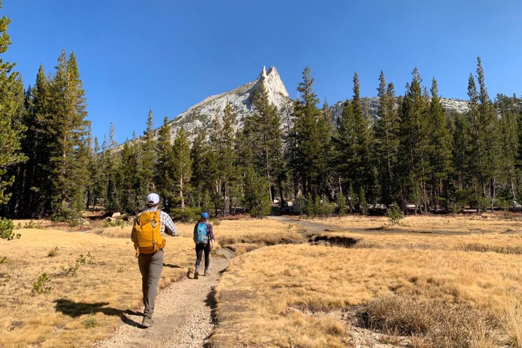
#2. Cathedral Lakes
Distance: 8.6 miles roundtrip
Elevation Gain: 1,700 ft.
Best Time to Go: when Tioga Road is open. Check local conditions, as it’s usually closed November – May.
Trailhead: Directions. Plan to park along the shoulder of Tioga Road, close to the trailhead.
Near Tuolumne Meadows, Cathedral Lakes is arguably the most popular of the “high country” trails.
You’ll pass through crisp subalpine forest for most of the way, including a sharp incline the first 1.5 mile to shock the system. Once the trail levels out, you’ll know you’re close to the reason you hiked: the Cathedral Lakes are High Sierra splendor, with glistening blue basins, accented by verdant meadows and the jagged Cathedral Peak behind.
You’ll reach Upper Cathedral Lake first, with Lower Cathedral Lake another 0.5 miles beyond.
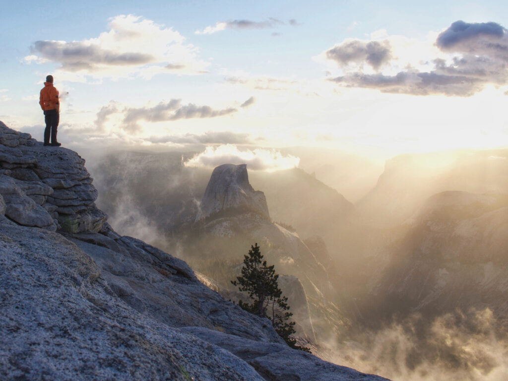
#3. Clouds Rest
Distance: 12.2 miles roundtrip
Elevation Gain: 3,100 ft.
Best Time to Go: when Tioga Road is open. Check local conditions, as it’s usually closed November – May.
Trailhead: Directions. Plan to park in the small parking lot of along the shoulder of Tioga Road. Follow the Sunrise Lakes trailhead for approx. 2.5 miles before you bear right to continue on to Clouds Rest.
Often considered one of the hardest hikes in Yosemite, Cloud’s Rest starts at Tenaya Lake and climbs a brutal 3,100 feet (with flat stretches interspersed) to Clouds Rest peak. It’s a challenging ascent, and anyone attempting Clouds Rest should be pretty fit.
Along the way, you’ll pass pristine forests, grassy meadows, and placid little lakes. The last short scramble to the summit is up a narrow ridge with drop-offs on both sides.
It’s not for the faint of heart, but you’ll be rewarded with an exhilarating panorama of Yosemite, accented by the back side of Half Dome in the foreground.
The sense of accomplishment and awe that you’ll feel at the summit (not to mention the screaming of your legs) is probably unmatched by any other Yosemite trail save Half Dome (below).
#4. Upper Yosemite Falls
Distance: 6.6 miles roundtrip
Elevation Gain: 3,250 ft.
Best Time to Go: open year-round, assuming no heavy snowfall. Check local conditions.
Trailhead: Directions. If there’s no parking available in the Camp 4 lot, you can use the Yosemite Falls parking lot across the road, or park along the shoulder of Northside Drive as permitted.
While a shorter total distance than the other trail on this list, the massive elevation gain compressed into shorter mileage makes this one an aggressive undertaking.
For those up to the challenge, the reward is the unparalleled birds eye view of Yosemite Valley. You’ll get up close and personal to Yosemite Falls (North America’s tallest waterfall), while Half Dome appears at eye level across the valley.
Gazing down on the distant green meadows far below, you’ll be amazed that you ascended so high, so quickly.
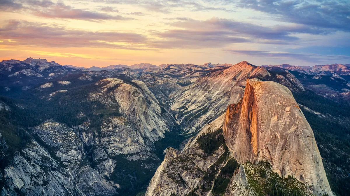
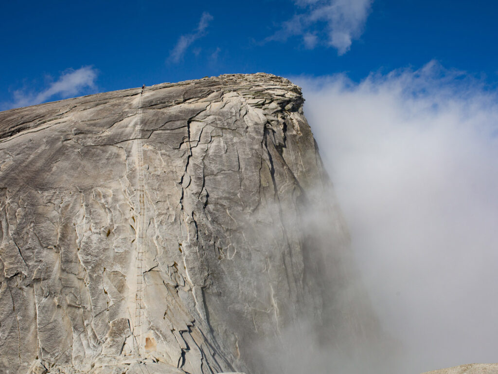
#5. Half Dome
Distance:16.5 miles roundtrip
Elevation Gain: 5,300 ft.
Best Time to Go: whenever the cables are up. Cables are usually operational June – October each year, depending on weather conditions. Check local conditions.
Trailhead: Directions. Trailhead is only accessible by foot. Park by Happy Isles/Curry Village, either along the road or at the parking lot and follow the Mist Trail signs about 0.5 – 1 mile along the road, depending on where you parked.
The granddaddy of them all, Half Dome is internationally famous and for good reason. Summiting the famous monolith takes not only fitness and physical strength, but a certain fearlessness of heights: the last 400 feet require pulling yourself up via cables, with a steep drop-off on either side.
As one of the most popular adventures in Yosemite, Half Dome requires permits that are highly competitive. Permit applications are accepted March 1 – 31 each year and awarded in mid-April. A few additional permits become available 48 hours before any given day (read more about the permit lottery here).
If you do decide to climb Half Dome, be sure to read the park’s official safety page before your attempt. This is no easy day hike, and requires meticulous planning. But don’t feel dissuaded – 300 people summit Half Dome on any given day, and the bragging rights last a lifetime.
Looking for an easier hike in Yosemite, to acclimate before attempting one of the trails above? Check out our recommendations for the best easy and moderate hikes in Yosemite National Park.