A popular day hike near San Francisco and the North Bay, Tomales Point provides panoramic views of the Point Reyes National Seashore. Expect to see numerous resident tule elk along the way, as this narrow peninsula doubles as an elk reserve.
Elevation gain is minimal, making this hike a good way to get decent mileage without too much effort. It’s well suited for children and families.
Distance: 9.5 miles roundtrip (out and back)
Estimated Time: 4 hours (or 3 hours for fast hikers)
Elevation Gain: 1,200 feet
The drive to the trailhead is a treat in itself, meandering the back roads of Marin Country through quaint towns, windswept hills, and sprawling dairy farms.
Be advised that there are no gas stations, food services, or potable water near Tomales Point. Come prepared, with enough food, water, and gas for your vehicle. Cell reception is nonexistent.
Where to Park
Parking is free, and located at the old Pierce Point Ranch (directions here). However, the lot is small and easily fills up on weekends. Plan to get there early to avoid the crowds. As an added benefit, the trail is much better when you have it nearly to yourself!
Tomales Point Trail
Trailhead
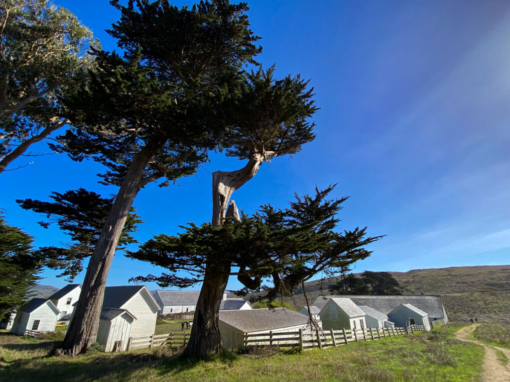
The trailhead starts at Pierce Point, a historic dairy ranch dating from the 1850s. Many of the buildings still stand, and are now well maintained by the National Park Service.
It makes an interesting 10-minute detour at the beginning or end of your hike, to explore the grounds and imagine how isolated life was here 150 years ago.
At the trailhead, you can either go straight, for a moderately steep 0.4 mile scramble down to McClures Beach, or hook right for the trail out to Tomales Point. The path follows an old ranch road, and is clearly designated for the 4.75 miles out to the point.
Tomales Point Trail
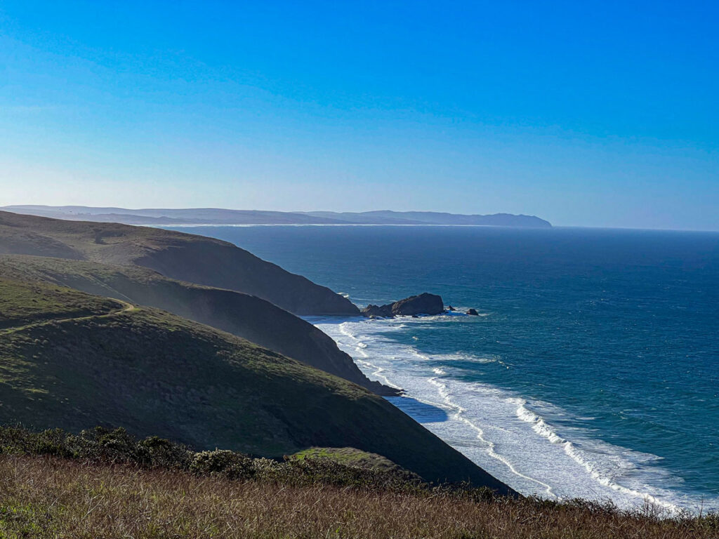
For the first 0.5 mile, you’ll hike due west along the hillside, before the trail reaches the ocean bluffs and cuts north. This is the first of the expansive views you’ll become familiar with over the course of 9.5 miles.
Be sure to look backwards to the south from time to time! The dramatic cliffs along the Point Reyes peninsula create a beautiful layering effect, especially with lingering morning fog.
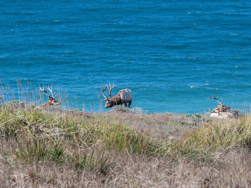
About 1 mile in, you’ll start seeing tule elk regularly. At the confluence of Windy Gap, where the trail dips minutely between two large land masses, is White Gulch. Look to the right, and there will inevitably be elk lounging among the tall grasses in the gulch below.
From here on out, elk become frequent companions to your hike.
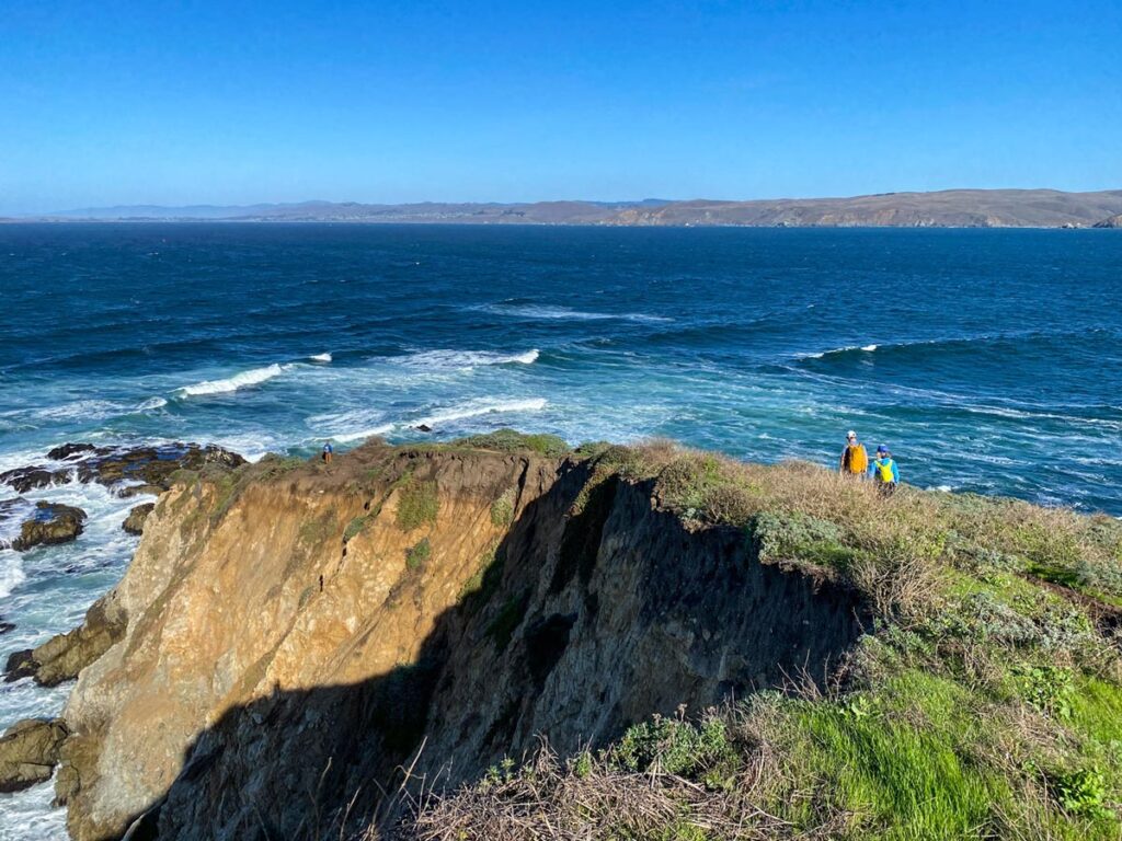
Just past Windy Gap, you’ll have a short elevation burst up to the ridgeline, before the trail levels out along bluffs. The path stays towards the Pacific Ocean side of the peninsula, but starting around 1.5 miles in, you’ll also see the “mainland” across Tomales Bay.
The little dotted hamlets directly across the water are Dillon Beach, while to the north is the larger community of Bodega Bay, snaking down the hillsides to the ocean.
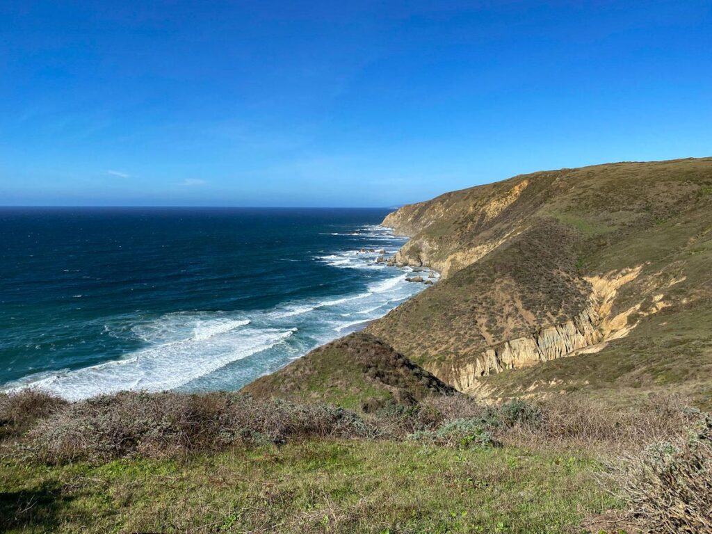
Approximately 2.25 miles into your hike, you’ll see what appears to be a second bluff to the north. The promontory looks like you’re almost there, but you still have over 2 miles to go (…sneaky!).
Once the promontory comes into view, you’ll follow the trail downhill 0.75 miles to a short saddle that straddles the two landmasses. This is your second (and last) little burst of uphill, to reach the crest.
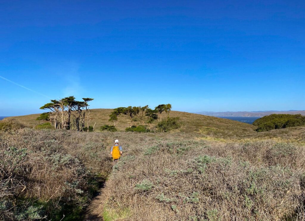
The last 1.25 miles tease, with intermittent spots of thick, soft sand to slog through. Tall scrub brush can obscure the trail at times on the final stretch, but don’t worry – it’s impossible to get lost. Just keep walking in the same direction, and the paths will inevitably converge back into each other.
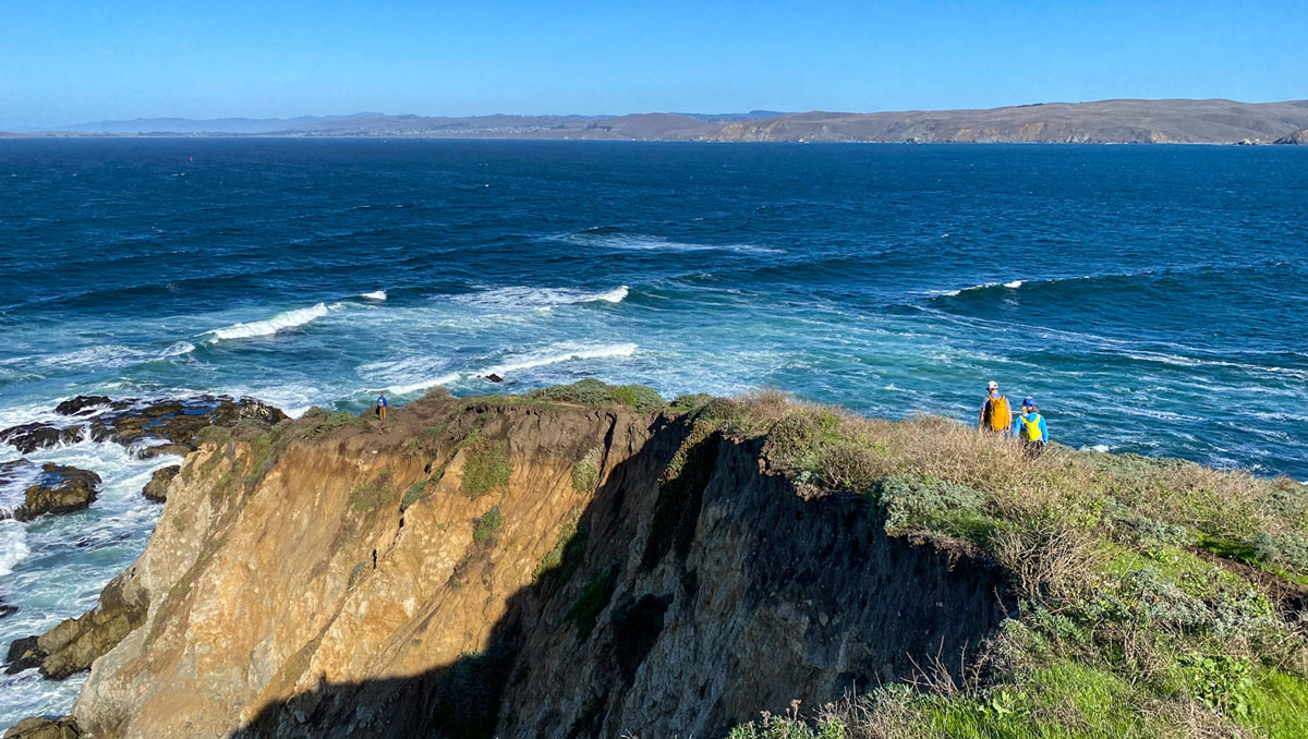
The last 50 yards, you’ll descend a narrow footpath to the very tip of Point Reyes Peninsula, leveling off to 360-degree views of wide Bodega Bay to the east, and the mighty Pacific to the west.
Here, the unforgiving ocean roars as it crashes onto the rocks below, while birds swoop and dive over the frothing tides. It’s a rugged, desolate beauty, and a gorgeous stretch of northern California coastline.
Once you’ve taken time to admire the views and snapped some obligatory photos, it’s back the way you came.
Tip: if you're looking for a post-hike bite to eat, the Marshall Store is one of our all-time favorites and worth the drive. They offer some of the freshest seafood around, with oysters, sandwiches, soups, and more in a vintage 1920s setting.
Wildlife and Safety
Point Reyes’ vicinity to large metro areas can bring many people who aren’t otherwise used to the outdoors. Thus, it doesn’t hurt to stress a few safety points:
- Ocean: the ocean here is wild and unruly. Keep a safe distance, and be aware of sneaker waves (rogue waves that appear out of nowhere).
- Bluffs: the bluffs can be unstable, with dry grasses keeping a tenuous hold on the ground. Always stay on the path, and never venture off trail to the edge of the cliffs.
- Elk: these are wild animals, and deserve to remain so. Enjoy watching them from a safe distance – never approach them up close, and watch their body language. If they appear alert and agitated, back up to give them more room.